Convolutional neural networks trained on tens of thousands of soil profile images now classify the National Cooperative Soil Survey texture class with 74-81% accuracy from a smartphone photo. This achievement, competitive with traditional field morphological assessment, fundamentally reshapes the speed and consistency of soil characterization for professionals in precision agriculture and environmental consulting. The National Cooperative Soil Survey's KSSL database, with its 60,000 laboratory-verified pedons, serves as the essential ground truth for this deep learning training task, providing the rigorous data foundation necessary for reliable model performance. These systems offer significant gains in efficiency and data standardization.
These advanced computer vision systems analyze visual cues within an image that a human eye would interpret: aggregate size, color gradients, and the subtle variations in light reflection that betray particle size distribution. Soil texture, the relative proportions of sand, silt, and clay particles, profoundly influences water infiltration, nutrient retention, and structural stability. Traditional field methods rely on an experienced hand-texturing a moist soil sample, a skill requiring years to perfect. Automated image analysis, using techniques like sRGB to CIELab conversion for consistent Munsell hue classification, achieves 82% accuracy in color notation without a physical color chart, offering an objective alternative.
What the Data Shows
The efficiency gains are significant. Transfer learning, where models pre-trained on vast general image datasets like ImageNet are fine-tuned for soil, reduces the required training samples for soil texture classification by 60-75%. This means deployable models can be developed with far less bespoke data. These smartphone-deployable models run at 200ms inference, providing near-instantaneous feedback. Beyond texture, similar deep learning approaches, using Sentinel-2 multispectral time series, predict soil drainage class with 71% overall accuracy nationally, demonstrating the broader applicability of machine learning to soil properties that influence crop phenology.
For agronomists, this translates to faster, more frequent site-specific soil assessments, informing precision fertilizer applications or irrigation scheduling. For engineers, rapid texture classification can flag areas with potential foundation issues or compaction risks. While object-based image analysis of high-resolution aerial imagery already delineates soil surface units matching SSURGO map unit boundaries with 73-79% accuracy, the ability to derive texture from an in-situ profile photo adds a key vertical dimension. This integration of computer vision with existing soil data frameworks offers a powerful new layer of intelligence for land management decisions, reducing reliance on time-consuming manual surveys and enhancing the granularity of soil information available at the point of decision.
Computer Vision Soil Classification — Accuracy by Method
| State / Region | Accuracy (%) |
|---|---|
| Random Forest + LiDAR + Spectral | 88% |
| CNN Soil Texture (field photo) | 78% |
| OBIA Boundary Detection | 76% |
| Transfer Learning (fine-tuned) | 74% |
| Sentinel-2 Time Series | 71% |
| Munsell Color (phone photo) | 82% |
The Regional Picture
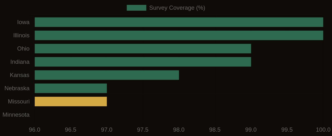
SSURGO Data Coverage — National Survey Completeness