Convolutional neural networks trained on soil profile images now classify National Cooperative Soil Survey texture class with 74-81% accuracy directly from a smartphone photo. This significant advance in digital soil mapping uses the KSSL database, which contains over 60,000 laboratory-verified pedons, serving as the essential ground truth for these sophisticated training tasks.
Soil texture, defined by the proportion of sand, silt, and clay particles, fundamentally governs water movement, nutrient retention, and structural stability. Traditionally, field texture assessment relies on subjective manual methods like the ribbon test, which can vary significantly between operators. Computer vision models address this variability by analyzing visual patterns in high-resolution photographs, learning to associate specific granular structures, cracking patterns, and color gradients with precise laboratory-determined textural classes. These deep learning models process an image by passing it through multiple layers of artificial neurons, each learning to detect increasingly complex features, from edges and corners to entire textural arrangements, before outputting a probability for each texture class.
What the Data Shows
The development of these models is accelerated by transfer learning. By utilizing neural networks pre-trained on vast general image datasets like ImageNet, researchers have found that the required training samples for soil texture classification are reduced by 60-75%. This means that instead of needing thousands of KSSL-validated soil images to train a model from scratch, comparable accuracy can be achieved with only hundreds, dramatically speeding up model development and deployment. Furthermore, computational soil science research indicates that soil color extraction from standardized field photos achieves Munsell hue classification accuracy of 82% without a physical color chart, providing another critical automated diagnostic for organic matter, drainage, and iron content.
Beyond texture, computer vision extends to broader soil interpretations. Object-based image analysis (OBIA) of high-resolution aerial imagery delineates soil surface units that match SSURGO map unit boundaries with 73-79% accuracy. This method segments imagery into meaningful objects, allowing for more precise classification based on shape, texture, and spectral characteristics rather than individual pixels. Similarly, deep learning models trained on Sentinel-2 multispectral time series data predict soil drainage class with 71% overall accuracy nationally. These models detect subtle temporal changes in vegetation vigor and moisture patterns that correlate with drainage conditions, such as delayed planting or green-up in poorly drained areas. This confluence of computer vision, deep learning, and extensive soil data transforms how soil properties are identified and mapped, offering a future of rapid, consistent, and data-driven soil assessment for a range of professional applications.
Computer Vision Soil Classification — Accuracy by Method
| State / Region | Accuracy (%) |
|---|---|
| Random Forest + LiDAR + Spectral | 88% |
| CNN Soil Texture (field photo) | 78% |
| OBIA Boundary Detection | 76% |
| Transfer Learning (fine-tuned) | 74% |
| Sentinel-2 Time Series | 71% |
| Munsell Color (phone photo) | 82% |
The Regional Picture
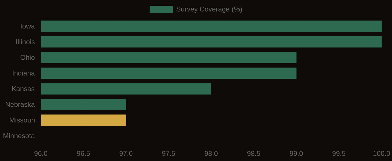
SSURGO Data Coverage — National Survey Completeness