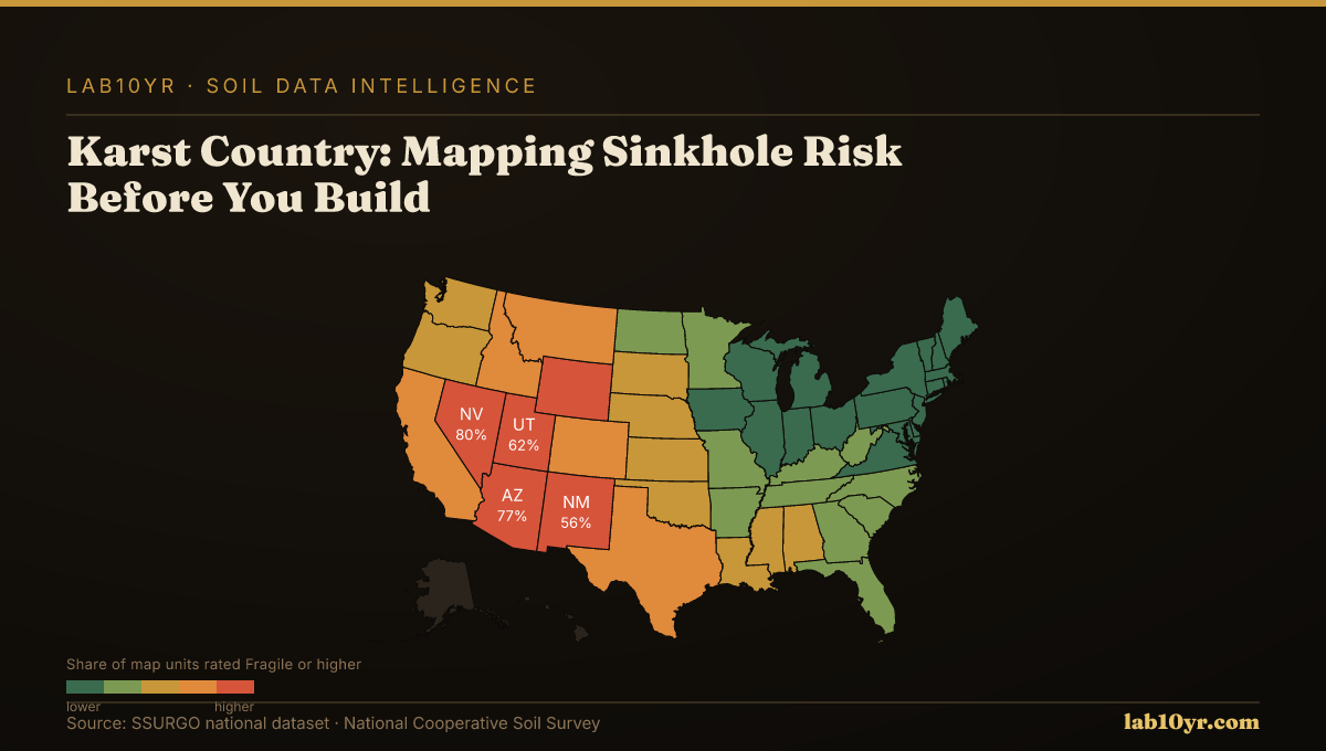
Karst geology underlies 20 percent of the United States. Every square kilometer is marked in your soil survey data. Sinkholes can appear suddenly. They swallow buildings, a major concern for infrastructure projects.
The complexity of the data landscape is evident. SSURGO data reveals that 13.3 percent of rated map units carry a Fragile or higher FSI rating, translating to 28,122 of 211,283 rated map units at risk. Nevada, Arizona, and Utah have the highest share of such ratings, at 80 percent, 77 percent, and 52 percent, respectively. The national average Fragile Soil Index value is 0.272 on a 0-to-1 scale, with values above 0.5 indicating elevated fragility risk.
Where the Risk Lives
SSURGO covers all 50 states and U.S. territories, encompassing 315,543 map units. A significant concern is that 71.6 percent of rated map units have Moderately high or High organic matter depletion risk, affecting soil stability. Most of the national soil map carries some level of fragility concern. Only 1,434 map units, or 0.7 percent, are rated Not fragile.
No risk. Limestone dissolution creates sinkholes, a major concern in karst geology. This can lead to costly repairs or total loss of a building. Geotechnical engineers must assess the soil before construction. Soil survey data provides critical information, helping engineers make informed decisions.
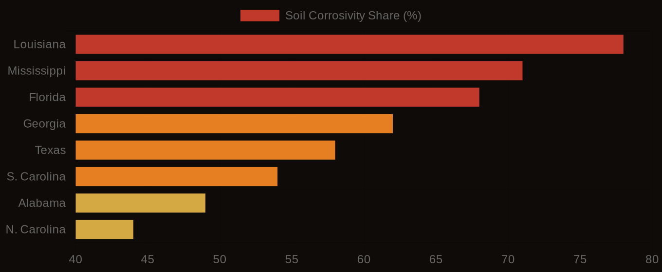
Soil Corrosivity Risk - Top U.S. Infrastructure States
| State / Region | High Corrosivity (%) |
|---|---|
| Louisiana | 78% |
| Mississippi | 71% |
| Florida | 68% |
| Georgia | 62% |
| Texas | 58% |
| S. Carolina | 54% |
| Alabama | 49% |
| N. Carolina | 44% |
| Virginia | 38% |
| Pennsylvania | 31% |
The Cost Nobody Budgets For
Soil intelligence changes everything. Developers and planners can avoid high-risk areas, choosing safer locations instead. This reduces sinkhole risk and costly repairs. Municipal planners use this data to create safer infrastructure, identifying areas with high fragility risk and planning accordingly. A major advantage, it saves time and money.
Developers and planners can take practical steps. Use soil survey data to assess sinkhole risk. Choose safer locations. The data is available and reliable. Contact us at info@lab10yr.com, explore the data at lab10yr.com, or support this work at ko-fi.com/lab10yr.
Soil Corrosivity Risk - Infrastructure Exposure by State