Anaerobic soil conditions accelerate steel pipeline corrosion at rates the industry has documented but rarely mapped in advance. In saturated, oxygen-depleted zones, microbial activity shifts, creating a highly corrosive environment for buried infrastructure. This microbially induced corrosion (MIC) often involves sulfate-reducing bacteria consuming electrons from steel, leading to localized pitting and structural compromise, even on cathodically protected pipes. Proactive identification of these zones is critical for risk management.
Saturated soils, where water fills nearly all pore spaces, cut off oxygen supply, forcing microorganisms to use alternative electron acceptors like sulfate. Over time, these conditions manifest as hydric soil indicators: distinct redoximorphic features such as gleyed horizons or prominent mottles, observed during field investigations. The National Cooperative Soil Survey characterizes these properties through the `drainage_class` attribute (in SSURGO's `component` table) and the `hydric_rating` (in `co_hydric_soil_all`). A "poorly drained" or "very poorly drained" classification, or a "Yes" hydric rating, flags areas vulnerable to MIC.
Where the Risk Lives
Consider the poorly drained Tifton series (Typic Paleudults) across Georgia's Coastal Plain. Localized depressions within these map units can experience prolonged saturation, transforming generally well-drained landscapes into pockets of high corrosion risk. Similarly, the high organic matter Histosols of Florida's Everglades, with their permanent saturation, pose extreme challenges for pipeline integrity, demanding specialized coatings and rigorous cathodic protection that may still fail under intense MIC.
The economic consequences of unforeseen pipeline corrosion are substantial. The 2010 San Bruno, California, natural gas pipeline rupture, for instance, resulted in over $1.6 billion in fines and civil penalties. Such incidents highlight the catastrophic potential of pipeline failure. Mapping high MIC risk areas *before* construction, or identifying existing high-risk segments for targeted mitigation, is key. Proactive costs - rerouting, specialized coatings, or increased monitoring - pale against environmental cleanup, regulatory penalties, and reputational damage. A pipeline through a poorly drained Pima series in Arizona's irrigated valleys, for instance, demands more frequent integrity digs than an adjacent segment in well-drained uplands.
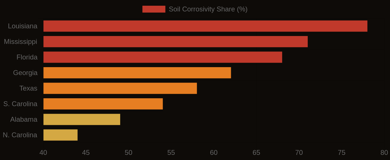
Soil Corrosivity Risk — Top U.S. Infrastructure States
| State / Region | High Corrosivity (%) |
|---|---|
| Louisiana | 78% |
| Mississippi | 71% |
| Florida | 68% |
| Georgia | 62% |
| Texas | 58% |
| S. Carolina | 54% |
| Alabama | 49% |
| N. Carolina | 44% |
| Virginia | 38% |
| Pennsylvania | 31% |
The Cost Nobody Budgets For
Accessing this critical data involves querying the National Cooperative Soil Survey's SSURGO database via Soil Data Access. Key tables include `mapunit` (for `mukey`), `component` (joined via `mukey` for `compname` and `drainage_class`), and `co_hydric_soil_all` (joined via `compkey` for `hydric_rating`). We analyze these attributes to provide precise, location-specific insights into soil corrosivity, aiding engineers in routing decisions and environmental compliance teams in risk assessments.
By moving beyond reactive maintenance to proactive, data-informed risk mapping, pipeline operators can significantly reduce the likelihood of corrosion-related failures. The unseen forces within saturated soils pose a measurable threat, yet one that precise soil data, diligently applied, can effectively preempt.
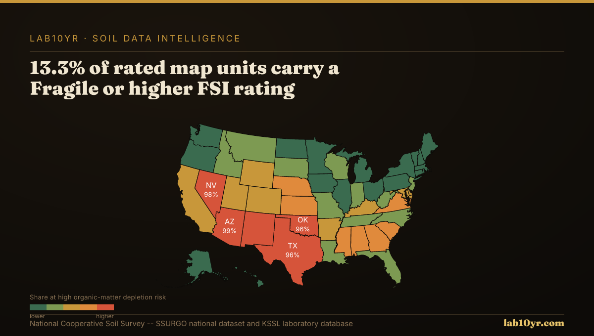
Soil Corrosivity Risk — Infrastructure Exposure by State