Federal surface mine regulations demand the segregation and replacement of topsoil. This prescriptive approach, while well-intentioned, often falls short of restoring long-term ecosystem function or agricultural productivity. The critical gap lies in assuming that surface material alone dictates the potential of reclaimed lands; in reality, the success of revegetation hinges on reconstructing a functional soil profile, a detail rarely informed by specific soil map unit data in standard reclamation plans.
True soil profile reconstruction extends far beyond simply spreading salvaged topsoil. Beneath the fertile A horizon, the subsoil (B and C horizons) provides essential rooting depth, water holding capacity, and nutrient cycling. Undisturbed soils develop specific sequences of these horizons, each with distinct physical and chemical properties like bulk density, clay content, and pH. When these layers are mixed or compacted during mining, the resulting "disturbed soils" often exhibit dramatically altered hydrology and nutrient availability, directly impeding revegetation success and long-term soil quality.
The Regional Concentration
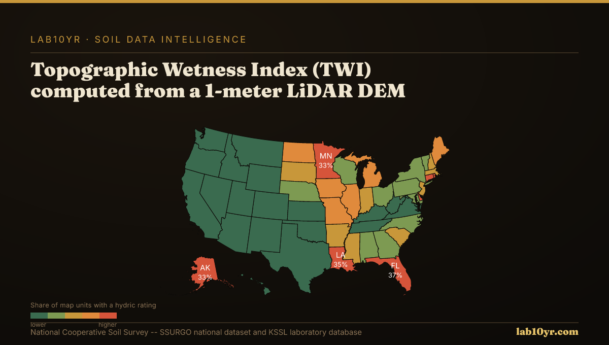
Understanding the original, undisturbed soil conditions is thus essential. High-resolution LiDAR terrain derivatives offer a powerful pre-mining assessment tool, predicting critical soil properties before the shovel even breaks ground. For instance, the Topographic Wetness Index (TWI), which quantifies water accumulation potential, predicts SSURGO drainage class with 78-84% accuracy, outperforming simpler elevation models. Similarly, terrain curvature, encompassing profile and plan curvature, can predict depth to restrictive layers within 30 cm accuracy in 70% of complex terrain sites, a vital metric for deep-rooted plant establishment. These digital soil mapping techniques use the close relationship between landform and soil development, allowing for more precise reconstruction planning.
Ignoring this underlying geopedology carries significant economic and ecological penalties. Without a functional reconstructed profile, reclaimed sites frequently struggle with poor drainage, shallow rooting, and accelerated erosion. Watershed erosion research in the Iowa Loess Hills, for example, shows that the Stream Power Index isolates 8-15% of watershed area responsible for 55-70% of measured sediment production, highlighting areas where inadequate soil structure leads to devastating runoff. This translates to repeated revegetation failures, increased maintenance costs, and potential non-compliance with regulatory performance standards, exposing operators to fines and protracted liability.
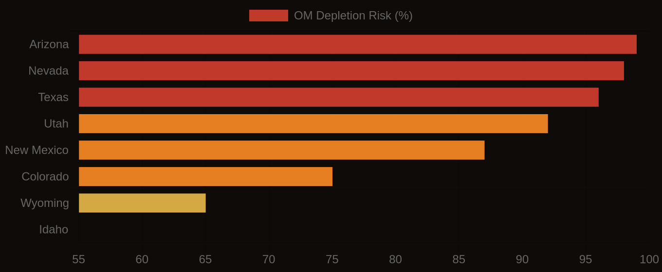
Organic Matter Depletion Risk by U.S. Region
| State / Region | Very High | High | Moderate | Low |
|---|---|---|---|---|
| Southwest | 72% | 20% | 6% | 2% |
| Great Plains | 48% | 32% | 14% | 6% |
| Southeast | 38% | 30% | 22% | 10% |
| Corn Belt | 22% | 28% | 32% | 18% |
| Mountain West | 61% | 22% | 12% | 5% |
| Pacific NW | 18% | 24% | 36% | 22% |
| Northeast | 12% | 20% | 40% | 28% |
The Valuation Gap
Effective mine reclamation requires moving beyond prescriptive topsoil replacement to data-driven soil profile reconstruction. By integrating SSURGO map unit data with advanced geospatial analysis of pre-mining terrain, land managers can develop targeted reclamation strategies that account for original soil series characteristics, drainage patterns, and restrictive layers. This proactive approach, informed by the National Cooperative Soil Survey's detailed information, ensures that the restored land truly achieves its productivity potential, safeguarding investments and environmental commitments.
Organic Matter Depletion Risk — State Overview