Object-based image analysis (OBIA) segments high-resolution aerial imagery into soil surface units with 77% accuracy against SSURGO map unit boundaries, dramatically outpacing manual digitizing which can take 10-15 hours per square mile in complex terrain.
Unlike pixel-based classification, OBIA first groups adjacent pixels into 'objects' based on spectral similarity, shape, and texture. These contextually meaningful segments then allow classification of distinct soil surface features--exposed mineral soil, organic layers, or moisture regimes. This refines National Cooperative Soil Survey data, offering granular and current views.
What the Data Shows
Precise identification of Histosols, organic soils, is a key OBIA application for carbon management. SSURGO maps 28 million acres of U.S. Histosols, which store an estimated 80 billion metric tons of soil carbon--20% of the nation's total. OBIA discerns spectral signatures of organic matter, accurately delineating these important areas. Drained peatlands release CO2 at 20-30 times the rate of mineral soils.
In Minnesota, home to 7.2 million acres of mapped Histosols--the largest concentration in the continental U.S.--OBIA provides a vital tool for monitoring these carbon-rich resources, distinguishing intact versus drained peatlands for conservation.
Computer Vision Soil Classification — Accuracy by Method
| State / Region | Accuracy (%) |
|---|---|
| Random Forest + LiDAR + Spectral | 88% |
| CNN Soil Texture (field photo) | 78% |
| OBIA Boundary Detection | 76% |
| Transfer Learning (fine-tuned) | 74% |
| Sentinel-2 Time Series | 71% |
| Munsell Color (phone photo) | 82% |
The Regional Picture
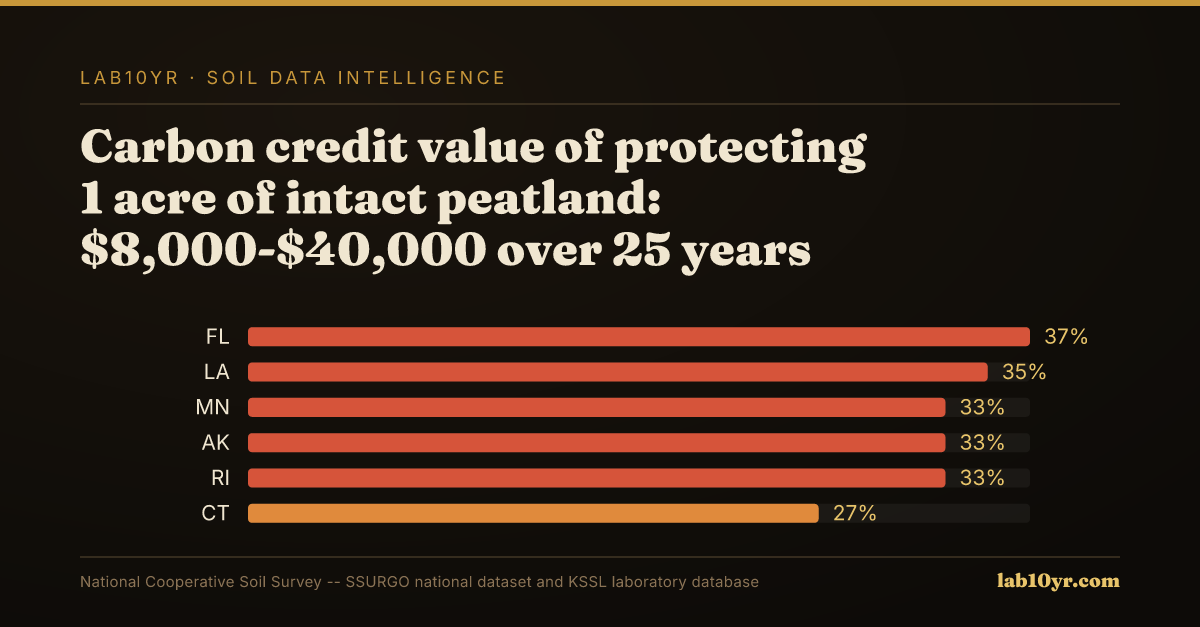
For environmental consultants, OBIA-derived Histosol maps inform carbon credit project viability. Quantifying carbon stock, verifiable via SSURGO and KSSL data, underpins the $8,000-$40,000 per acre value for protecting intact peatlands, validating conservation. Separately, civil engineers in California's Sacramento-San Joaquin Delta use refined OBIA classifications to identify compressible organic soils, preventing costly subsidence-related infrastructure failures and enhancing due diligence.
Accessing foundational data involves querying SSURGO tables like `mapunit`, `component`, and `co_comp_carbon` for soil properties and carbon estimates, complemented by KSSL laboratory data for bulk density. OBIA then provides critical, current surface-level detail enhancing these underlying interpretations.
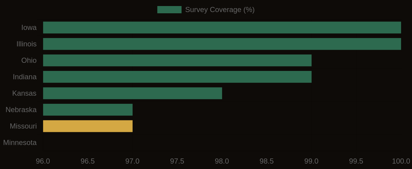
SSURGO Data Coverage — National Survey Completeness
What It Means in Practice
By transforming raw imagery into actionable soil intelligence, OBIA enables informed decisions across land management, environmental conservation, and resilient infrastructure planning, addressing risks and opportunities embedded in the dynamic soil surface.