More than 28 million acres of organic soils, known as Histosols, are mapped across the contiguous United States, silently complicating renewable energy development. These unique soil types, comprising decaying plant matter rather than mineral particles, store an estimated 80 billion metric tons of soil carbon. This immense carbon reservoir, roughly 20% of all U.S. soil carbon, exists within just 3% of the nation's land area, yet it presents significant geotechnical challenges and financial risks. SSURGO data offers critical answers in seconds, preempting the millions spent on late-stage geotechnical studies.
Histosols are characterized by high organic matter content, giving them very low bulk density and exceptionally high compressibility. This means they cannot bear substantial loads from wind turbines or solar arrays without significant deformation and settlement. When drained, the introduction of oxygen accelerates microbial decomposition, leading to rapid carbon oxidation and CO2 release, transforming these potent carbon sinks into sources. This process also causes significant land subsidence. KSSL laboratory data, specifically bulk density measurements, are essential for predicting settlement behavior.
What the Data Shows
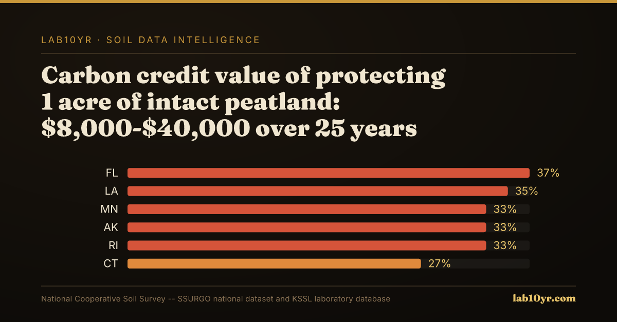
Consider Minnesota's extensive peatlands, accounting for 7.2 million acres of mapped Histosols. In these drained areas, subsidence rates average 1.5-2 centimeters per year. This ongoing settlement compromises foundation stability, demanding costly deep-pile foundations or extensive ground improvement techniques, escalating project expenses. Furthermore, drained peatlands release CO2 at 20-30 times the rate of undisturbed mineral soils, adding an environmental cost. The carbon credit value of protecting one acre of intact peatland can range from $8,000-$40,000 over 25 years, presenting an alternative financial consideration.
For renewable energy developers, understanding these subsurface conditions is essential. Misjudging Histosols can lead to millions in unexpected foundation costs for infrastructure, directly impacting project financing and long-term operational viability. Lab10YR uses the National Cooperative Soil Survey's SSURGO database to identify and characterize these challenging soil conditions. We query the `component` table, specifically the `taxorder` field, to pinpoint Histosols. Further analysis involves the `chorizon` table to assess `om` (organic matter) content and `dbthirdbar` (bulk density) values, which are direct indicators of a soil's compressibility and settlement potential. This data-driven approach enables rapid pre-screening of potential sites, flagging high-risk areas before significant investment.
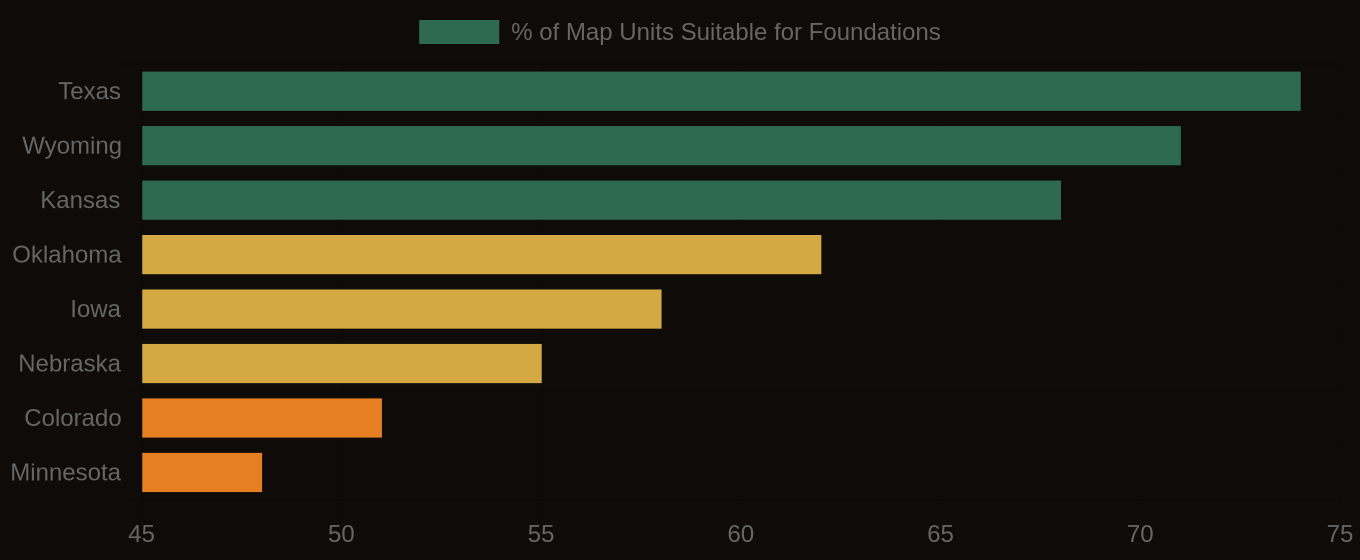
Soil Drainage Suitability — Top Wind & Solar States
| State / Region | Well/Exc. Drained (suitable) | Mod. Well Drained (marginal) | Poorly Drained (unsuitable) |
|---|---|---|---|
| Texas | 74% | 13% | 13% |
| Wyoming | 71% | 14% | 15% |
| Kansas | 68% | 15% | 17% |
| Oklahoma | 62% | 18% | 20% |
| Iowa | 58% | 22% | 20% |
| Nebraska | 55% | 20% | 25% |
| Colorado | 51% | 20% | 29% |
| Minnesota | 48% | 24% | 28% |
Where Exposure Is Highest
Integrating detailed soil data analysis into initial site assessment is not merely a technical exercise; it is a fundamental economic and environmental imperative. By addressing these critical soil characteristics early, developers can avoid costly delays, prevent structural failures, and contribute to climate resilience by preserving vital carbon sinks, ultimately enhancing the long-term sustainability of renewable energy projects.
Soil Foundation Suitability — Wind & Solar Energy States