A Phase I environmental site assessment costs thousands of dollars. Nothing, in contrast, is the cost of a SSURGO query, which runs in seconds. This disparity is striking, given the critical role soil data plays in land finance. Soil survey data, like that found in the SSURGO database, reveals geotechnical risks that threaten project viability.
The SSURGO database, maintained by the National Cooperative Soil Survey, offers a comprehensive look at soil conditions across the United States. It covers all 50 states and U.S. territories with over 315,543 map units, providing a detailed picture of soil quality and fragility. Notably, 13.3% of rated map units carry a Fragile or higher FSI rating, indicating a significant risk of soil instability. This information is vital for real estate developers and project finance teams, as it informs site investigation and due diligence efforts.
What SSURGO Reveals
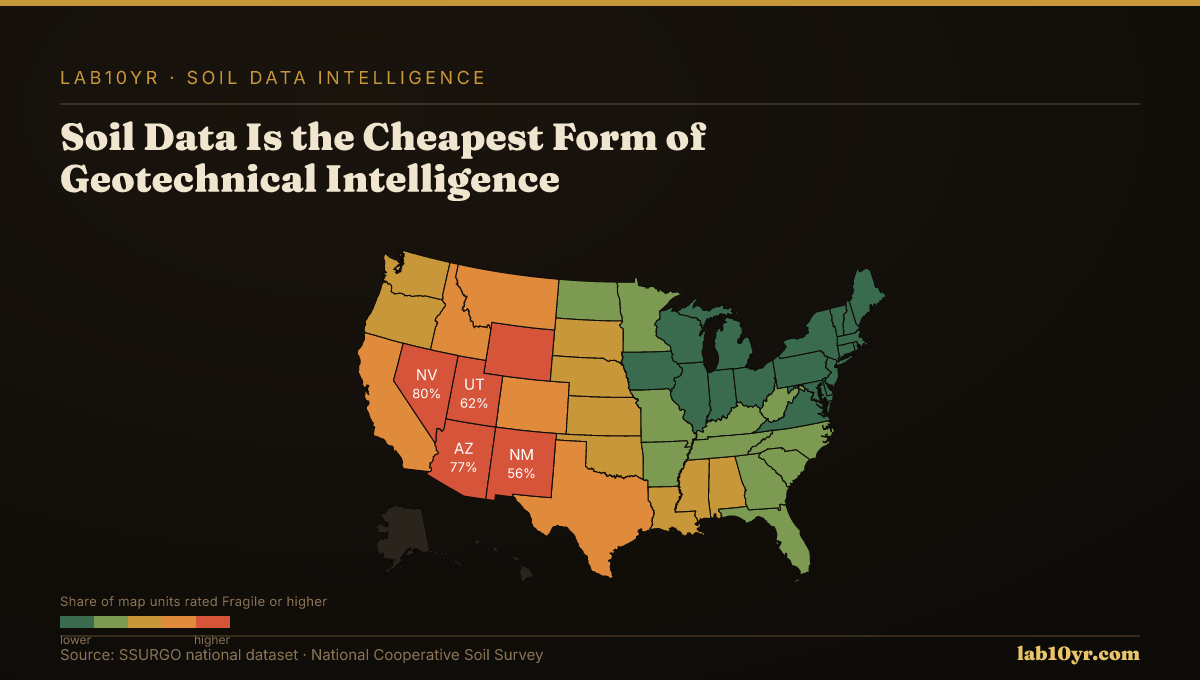
The national average Fragile Soil Index value is 0.272 on a 0-to-1 scale. Values above 0.5 indicate elevated fragility risk. Certain states, such as Nevada and Arizona, have average FSI values well above this threshold, at 0.521 and 0.495 respectively, suggesting that these regions may require more extensive geotechnical analysis to mitigate potential risks. Also, 71.6% of rated map units show Moderately high or High organic matter depletion risk, which can impact soil fertility and overall ecosystem health.
These statistics show the importance of integrating soil data into land finance decisions. By using SSURGO data, developers and financiers can identify potential geotechnical risks. This leads to more targeted and effective site investigation and mitigation efforts, resulting in significant cost savings, as seen in projects that require additional soil amendments or conservation measures to ensure long-term stability.
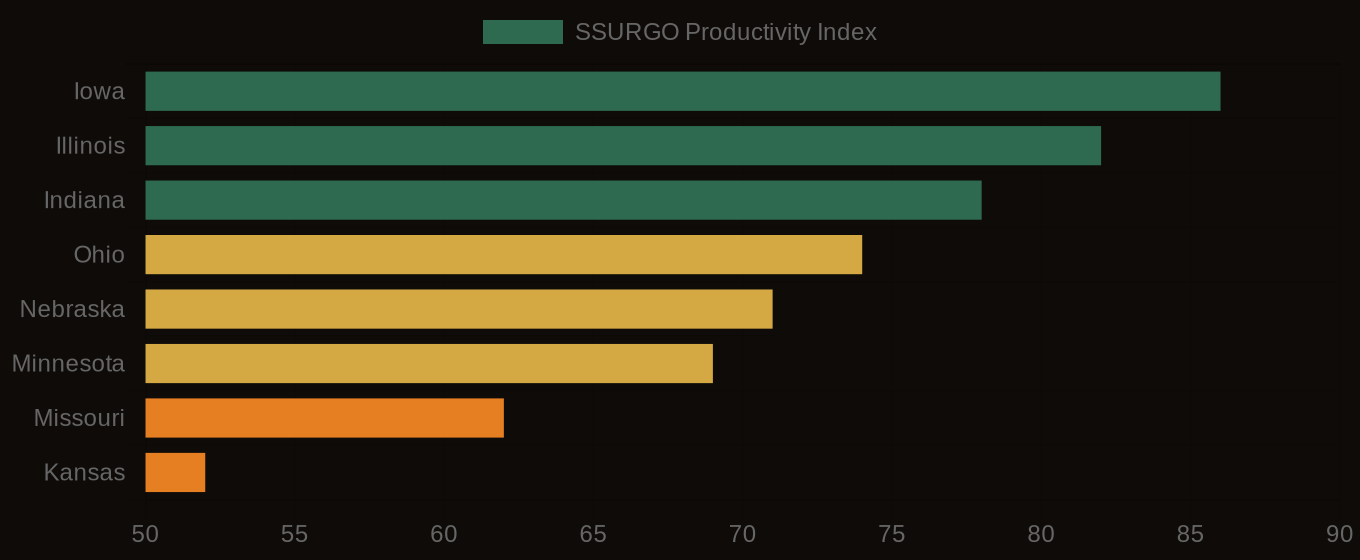
Soil Productivity Index vs. Cash Rent - Corn Belt States
States at Greatest Risk
Soil intelligence is a powerful tool for managing risk and optimizing returns in land finance. Analyzing SSURGO data helps investors and developers understand the geotechnical characteristics of a site. This helps them make more informed decisions about project viability, avoiding costly surprises down the line, such as unexpected soil instability or environmental remediation costs. The SSURGO database will likely play an increasingly important role in land finance and geotechnical risk assessment as it continues to grow and improve.
Soil data informs land finance decisions. Tapping into the SSURGO database's wealth of information enables developers and financiers to make more informed, data-driven decisions that minimize risk and maximize returns.com, or support this work at ko-fi.com/lab10yr.
Soil Productivity Index - Farmland Investment Map