Expansive soils cost U.S. homeowners over 15 billion dollars per year. Foundation damage is the culprit. This damage, caused by shrink-swell soils, is well understood by soil scientists. The risk is already mapped in the SSURGO dataset for every county, a valuable resource for homebuilders, foundation engineers, and property insurers. According to SSURGO data, 13.3% of rated map units carry a Fragile or higher FSI rating, indicating a significant level of foundation damage risk. Foundation failure is a major concern for homeowners and the insurance industry, and for good reason.
Nevada, Arizona, and Utah have the highest average FSI values, at 0.521, 0.495, and 0.405 respectively. Homes built in these areas are more likely to experience foundation damage due to the soil's shrink-swell properties. The data reveals a clear pattern: 71.6% of rated map units show Moderately high or High organic matter depletion risk, exacerbating the problem. The national average Fragile Soil Index value is 0.272, indicating widespread risk. The risk is real. This has significant implications for the insurance industry and homebuilders, who must consider soil conditions when assessing risk and designing foundations. It's not simple. SSURGO data can inform these decisions, helping to mitigate the risk of foundation failure and reduce the financial burden on homeowners. Many homes are built without considering soil conditions.
What SSURGO Reveals
The cost of foundation repair is high. Very high. Foundation engineers can use SSURGO data to design more resilient foundations. Property insurers can use it to assess risk more accurately. Homebuilders can choose building sites less prone to foundation damage. The SSURGO dataset is a powerful tool. Go to lab10yr.com to learn more about using SSURGO to inform decisions and reduce the risk of foundation failure.
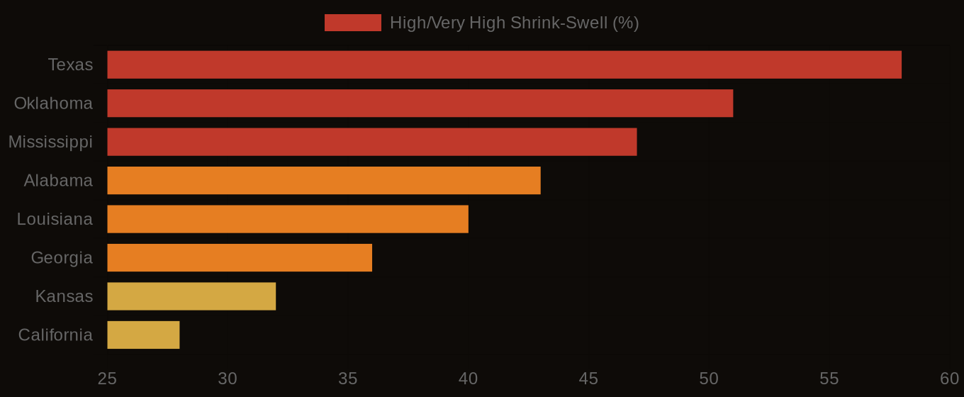
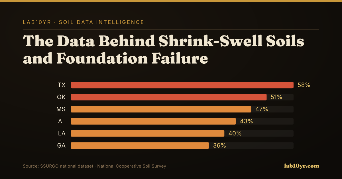
Shrink-Swell Soil Hazard - High & Very High COLE Class by State
| State / Region | High/Very High Shrink-Swell (%) |
|---|---|
| Texas | 58% |
| Oklahoma | 51% |
| Mississippi | 47% |
| Alabama | 43% |
| Louisiana | 40% |
| Georgia | 36% |
| Kansas | 32% |
| California | 28% |
| Missouri | 25% |
| Colorado | 22% |
Where Exposure Is Highest
Shrink-Swell Soil Hazard - Structural Damage Exposure