For over seventy years, the Kellogg Soil Survey Laboratory (KSSL) has been the National Cooperative Soil Survey's authoritative center for soil characterization. Its vast archive of soil measurements, publicly available for years, remains largely unqueried by the private sector, representing a significant missed opportunity for precision agriculture and environmental risk assessment.
KSSL meticulously analyzes pedons, the three-dimensional soil bodies that represent the full range of soil properties at a specific location. These analyses include fundamental properties like organic carbon content, determined by dry combustion, and bulk density, measured by core methods. Such precise laboratory measurements of physical and chemical properties serve as the indispensable ground truth for calibrating and validating remote sensing models. Indeed, the KSSL spectral library alone contains Vis-NIR-SWIR (Visible-Near Infrared-Shortwave Infrared) scans of more than 50,000 soil samples, each matched with detailed laboratory chemistry.
How the Query Works
This foundational KSSL data directly informs modern remote sensing applications. For instance, bare soil Vis-NIR-SWIR reflectance can predict soil organic carbon with R-squared values ranging from 0.75-0.88 across the Corn Belt, provided models are calibrated with geographically matched training samples. Multispectral drone imagery, at resolutions as fine as 5-cm, predicts soil organic matter with R-squared values of 0.82-0.87 from bare soil composites, outperforming satellite imagery for intra-field mapping. Moreover, a bare soil composite derived from two decades of Landsat imagery captures stable soil spectral signals, correlating with organic matter at 30-meter resolution by using temporal compositing to remove transient vegetation and atmospheric effects.
Beyond spectral analysis, KSSL's characterization data provides essential context for other remote sensing modalities. Sentinel-1 SAR (Synthetic Aperture Radar) backscatter, for example, detects surface soil moisture at 10-meter resolution, even under cloud cover or at night, as its C-band signal is sensitive to volumetric water content in the top 5 cm. When combined with SSURGO's detailed available water capacity (AWC) data, these remote moisture measurements, calibrated against KSSL ground truth, enable precise field-scale water deficit estimation for irrigation management and drought monitoring.
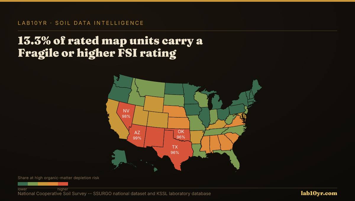
SSURGO + KSSL — National Dataset Scale
What the Results Show
The underutilization of the KSSL dataset by engineers, agricultural lenders, and land managers represents a critical bottleneck. Integrating these rich, publicly available lab measurements with remote sensing and SSURGO offers a powerful, cost-effective pathway to derive precise soil intelligence, supporting critical decisions in land valuation, crop yield optimization, and infrastructure planning.
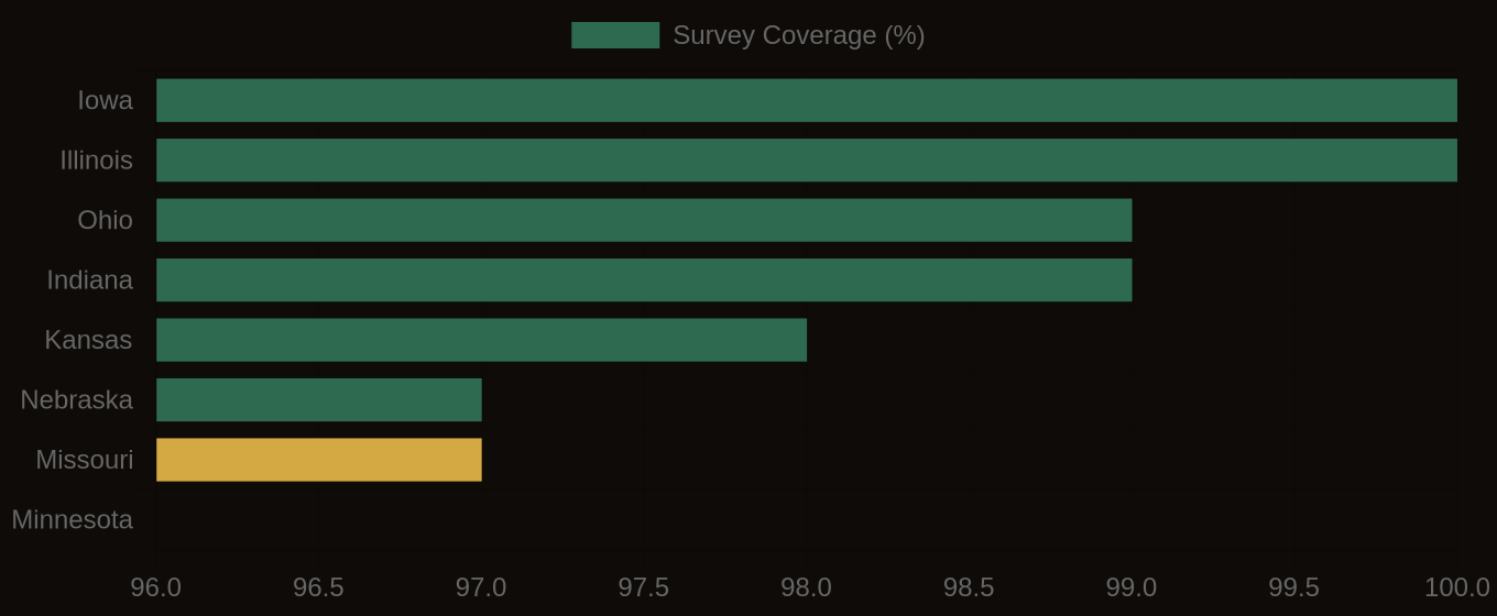
SSURGO Data Coverage — National Survey Completeness