Carbon markets require precise baseline soil organic carbon inventories to validate sequestration efforts and quantify credits. While the national SSURGO database provides a key starting point, its generalized polygon boundaries often mask the fine-scale variability essential for accurate accounting. We analyze how high-resolution terrain analysis can refine these baselines, offering a faster, more cost-effective approach than extensive field sampling alone.
Soil organic carbon (SOC) is primarily stored as organic matter (OM), the decomposed remains of plants and animals, in the top meter of soil. This OM is not uniformly distributed across the landscape; its concentration varies significantly with factors like drainage, slope, and depositional history. Soil scientists quantify organic carbon through laboratory analysis, often by combustion, with results expressed as a percentage of total soil mass. The KSSL laboratory database holds thousands of these direct measurements, while SSURGO's `chorizon` table contains estimated `om_r` (organic matter percentage) and `partic_wt_r` (bulk density) fields, key for calculating carbon stock.
The Regional Concentration
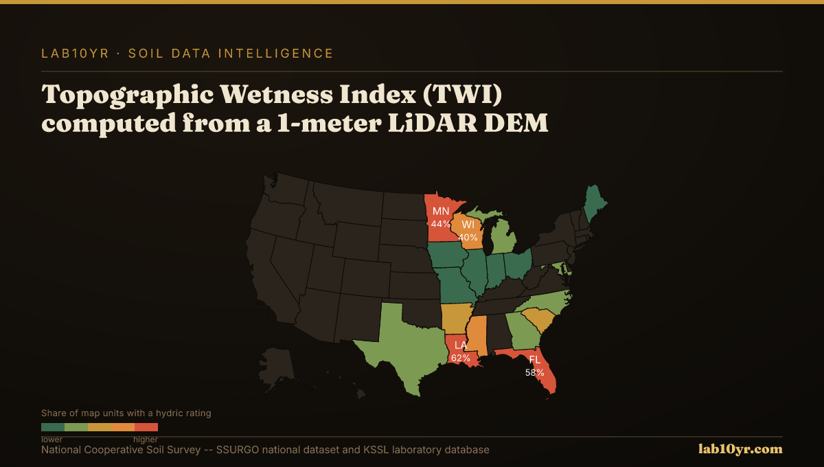
Integrating LiDAR-derived terrain metrics with SSURGO data significantly improves the spatial accuracy of soil carbon estimates. For instance, the Topographic Wetness Index (TWI), which quantifies water accumulation potential, predicts SSURGO drainage class with 78-84% accuracy. This directly impacts organic matter preservation, as saturated conditions inhibit decomposition. Similarly, LiDAR terrain derivatives, including curvature and slope position, predict soil series with 70-85% accuracy in cross-validation studies, outperforming simpler metrics. Geomorphon landform classification, derived from 1-meter LiDAR, identifies ten distinct terrain element types, each corresponding to predictable soil drainage and organic matter ranges across a soil catena. These include hollows and footslopes, where colluvial processes often lead to deeper, carbon-rich soils. Terrain curvature, both profile and plan, predicts depth to restrictive layers within 30 cm accuracy in 70% of complex terrain sites, a key factor in total carbon storage capacity.
For carbon market developers, sustainability directors, and land managers, this refined geospatial data allows for targeted sampling strategies, reducing costs by focusing field efforts on high-variability or high-potential zones. Instead of costly, grid-based sampling across an entire property, an organization can prioritize areas identified by terrain models as likely carbon sinks. This approach improves the defensibility of baseline inventories for verification protocols and enhances the credibility of carbon credit claims.
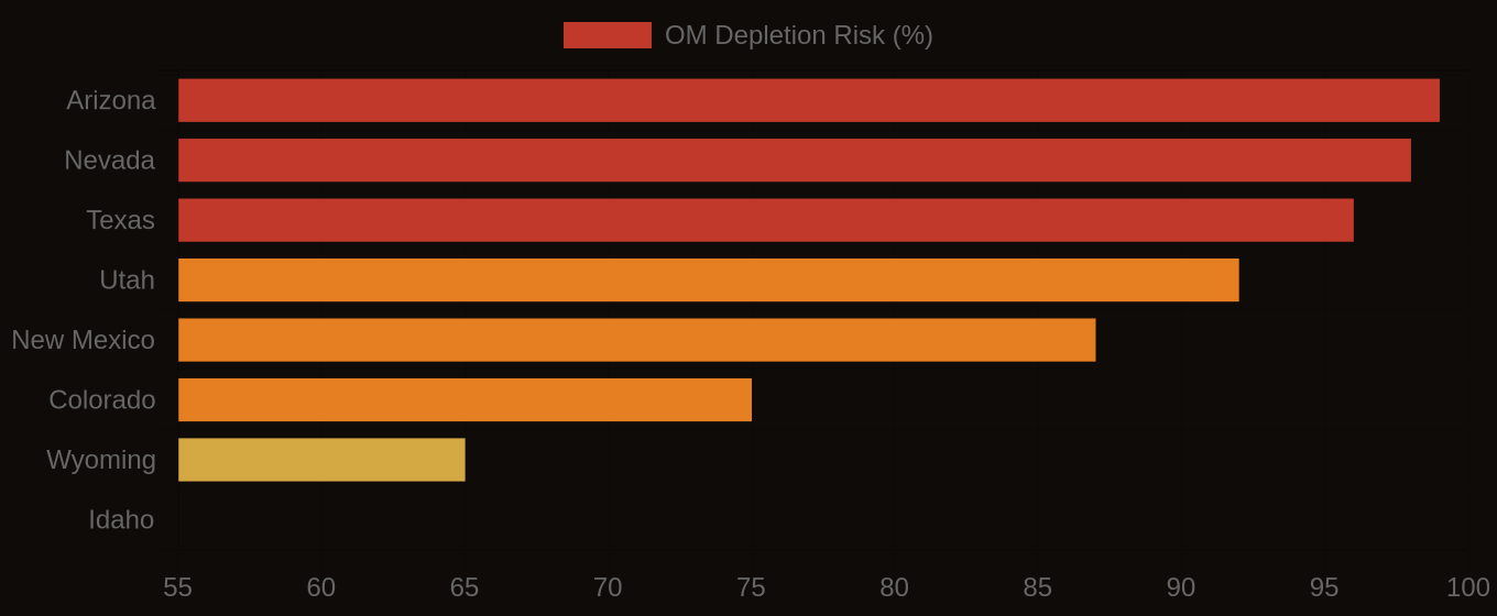
Organic Matter Depletion Risk by U.S. Region
| State / Region | Very High | High | Moderate | Low |
|---|---|---|---|---|
| Southwest | 72% | 20% | 6% | 2% |
| Great Plains | 48% | 32% | 14% | 6% |
| Southeast | 38% | 30% | 22% | 10% |
| Corn Belt | 22% | 28% | 32% | 18% |
| Mountain West | 61% | 22% | 12% | 5% |
| Pacific NW | 18% | 24% | 36% | 22% |
| Northeast | 12% | 20% | 40% | 28% |
The Valuation Gap
Access to this integrated data begins with SSURGO's `chorizon` table, where `om_r` (organic matter, percent) and `partic_wt_r` (bulk density, g/cm3) are key fields. Joining `chorizon` to `component` via `chkey` and `cokey` allows for map unit aggregation. Lab10YR.com provides pre-computed terrain derivatives and integrated soil properties, enabling rapid assessment of carbon sequestration potential across diverse land parcels.
By using the granular detail of LiDAR-derived terrain data alongside complete SSURGO interpretations, carbon market participants can establish more strong and cost-effective baselines. This precision is not just an academic exercise; it underpins the financial integrity and ecological effectiveness of every soil carbon project, ensuring that investments in sequestration yield verifiable environmental and economic returns.
Organic Matter Depletion Risk — State Overview