The Kellogg Soil Survey Laboratory (KSSL) spectral library contains over 50,000 soil samples with matched Vis-NIR-SWIR reflectance and laboratory chemistry measurements. It is the largest public soil spectral dataset in the world. Most remote sensing projects outside the National Cooperative Soil Survey have never heard of it, a significant oversight for those modeling soil properties from aerial or satellite platforms.
This library is a critical resource for calibrating and validating spectroscopic models. Visible-Near-Infrared-Shortwave Infrared (Vis-NIR-SWIR) reflectance spectroscopy measures how soil samples absorb and reflect light across specific wavelengths from roughly 350 to 2500 nanometers. This technique exploits the unique ways different soil constituents-like organic matter, clay minerals, and water-interact with electromagnetic radiation. Each component exhibits characteristic absorption and reflectance patterns, or spectral signatures, due to their molecular bonds and structural properties. By analyzing these patterns, laboratory instruments quantify soil properties rapidly and non-destructively.
What the Data Shows
The KSSL samples are meticulously prepared: dried, ground, sieved, and analyzed under controlled laboratory conditions, minimizing variability from moisture or particle size. Notably, each sample in the library is also characterized by a complete suite of traditional laboratory analyses, encompassing organic carbon content, precise texture (sand, silt, clay percentages), pH, cation exchange capacity, and iron oxide content. This dual measurement approach-spectroscopy paired with wet chemistry-creates an invaluable "ground truth" dataset. Researchers and developers then use this data to train sophisticated machine learning algorithms, effectively linking spectral signatures to precise, quantitative soil characteristics.
For remote sensing applications, this translates directly into actionable intelligence. Satellite or drone-mounted hyperspectral sensors capture reflectance data from the soil surface over vast areas. Models trained on the KSSL library can then accurately translate these remotely sensed spectra into reliable predictions of soil organic carbon content across agricultural fields, providing key data for carbon sequestration projects and the verification of carbon credits. Precision agriculture firms use similar models to map fine-scale nutrient variability within fields, enabling optimized, variable-rate fertilizer applications that reduce input costs and minimize environmental impact. This foundational library thus provides the essential, scientifically rigorous link between raw light signals and critical soil interpretations.
Soil Carbon Prediction Accuracy — Spectral vs. Traditional Methods
| State / Region | R² — SOC Prediction |
|---|---|
| UAV Multispectral (5cm) | 0.87% |
| Vis-NIR-SWIR Lab Scan | 0.84% |
| Sentinel-2 Bare Soil | 0.71% |
| Landsat Composite | 0.63% |
| Field Morphology | 0.55% |
| Grid Sampling | 0.48% |
The Regional Picture
This rich, publicly available dataset from the National Cooperative Soil Survey remains remarkably underutilized by many private ventures. For any firm developing soil-related remote sensing solutions-from carbon accounting to precision nutrient management-integrating the KSSL spectral library into their model development pipeline is not merely an option; it is foundational for building strong, accurate predictive models that meet professional standards and withstand scrutiny. At Lab10YR, we interpret the output of such models, ensuring the underlying soil data aligns with the physical reality and management implications of the landscape for our clients.
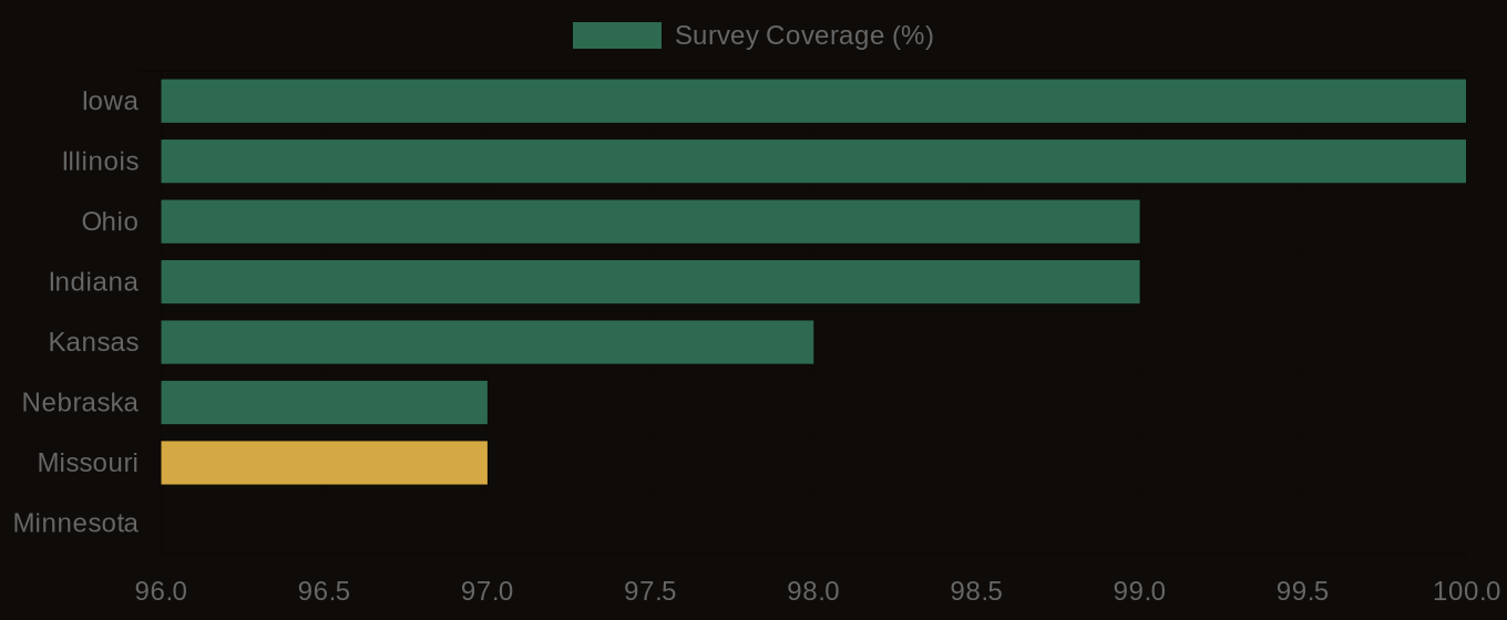
SSURGO Data Coverage — National Survey Completeness