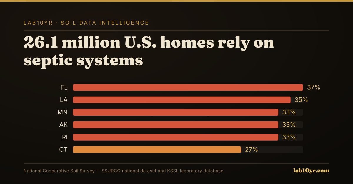
Twenty-six point one million U.S. homes, 21% of all housing units, rely on septic systems for wastewater treatment. A significant hidden risk exists: soils rated 'Severe' or 'Very Severe' for conventional septic systems cover 42% of the nation's rural land area. These unsuitable conditions lead to system failures, imposing repair or replacement costs from $3,000 to $30,000. Such substantial financial burdens are often preventable through meticulous pre-construction soil analysis.
Septic system performance hinges on critical soil properties governing effluent infiltration and treatment. The percolation rate, measuring how quickly water moves through soil, is essential, influenced by texture, structure, and porosity. Equally vital is the depth to the seasonal high water table, the shallowest groundwater level during wet periods. A high water table prevents adequate aerobic treatment and causes surface ponding. Restrictive layers, like dense clay pans, further impede downward flow, leading to effluent backup. The National Cooperative Soil Survey evaluates these factors for every SSURGO map unit, providing a 'Sewage Disposal' interpretation that categorizes limitations.
What the Data Shows
Certain soil types consistently show high septic failure rates. Clay pan soils, including many Fragiudults and Argialbolls, develop dense, impermeable subsoil horizons. These create seasonally perched water tables that overwhelm conventional absorption fields within five to fifteen years. This problem is pronounced in regions like the Piedmont of Georgia, where 61% of rural map units are rated 'Severe'. Dominant series such as Cecil, Madison, and Appling possess high-clay subsoils with low saturated hydraulic conductivity, severely restricting effluent infiltration.
For environmental consultants, engineers, and land managers, understanding these inherent soil limitations is essential for informed land-use decisions. Pre-purchase due diligence and site planning must incorporate SSURGO data, accessible via Soil Data Access. Professionals can query the 'cointerp' table and the 'interplimitation' field to identify high-risk soil series. This proactive approach enables alternative designs or different site selection, minimizing costly remediation, avoiding environmental hazards, and protecting long-term property value. Precise soil data analysis transforms hidden liabilities into manageable considerations.
Soil Carbon Prediction Accuracy — Spectral vs. Traditional Methods
| State / Region | R² — SOC Prediction |
|---|---|
| UAV Multispectral (5cm) | 0.87% |
| Vis-NIR-SWIR Lab Scan | 0.84% |
| Sentinel-2 Bare Soil | 0.71% |
| Landsat Composite | 0.63% |
| Field Morphology | 0.55% |
| Grid Sampling | 0.48% |
The Regional Picture
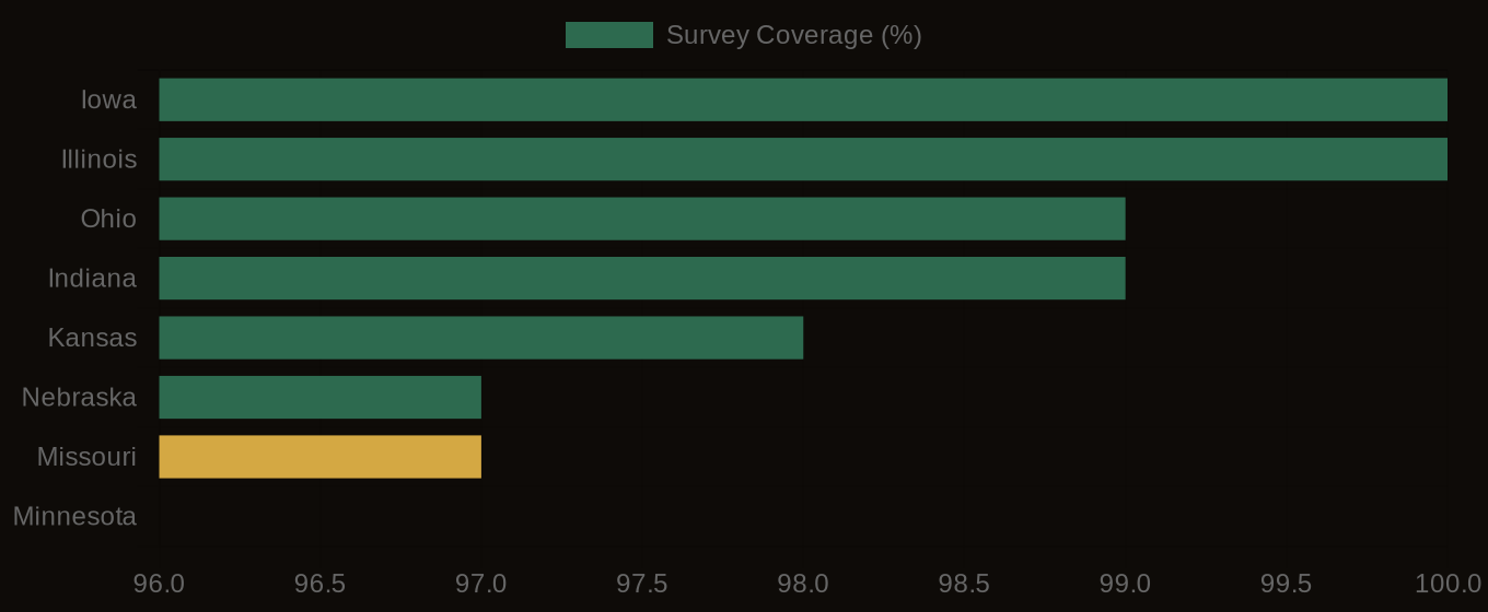
SSURGO Data Coverage — National Survey Completeness