The ability to detect sub-centimeter topographic change across vast areas for a mere $1,500 per drone flight is transforming post-disturbance land management. This level of precision, achieved through Structure-from-Motion (SfM) photogrammetry, directly replaces traditional ground-based survey campaigns costing upwards of $50,000 in contexts like mine reclamation and post-wildfire erosion monitoring. It provides environmental consultants and land managers with unprecedented detail to assess surface stability and sediment movement.
Structure-from-Motion photogrammetry operates by capturing hundreds of overlapping images from a low-altitude unmanned aerial vehicle (UAV). Specialized software then identifies unique features, known as tie points, across multiple images, reconstructing a dense three-dimensional point cloud of the terrain. From this point cloud, highly accurate digital elevation models (DEMs) are generated, depicting the ground surface with remarkable fidelity. By comparing DEMs from sequential flights, even subtle erosion gullies or depositional fans measuring just a few millimeters in depth or height become quantifiable, yielding precise volumetric calculations of material loss or gain. This direct measurement of surface morphology is key for evaluating the physical impact of disturbance.
What the Data Shows
While SfM photogrammetry excels at quantifying physical surface change, a holistic understanding of post-disturbance soil dynamics also requires insight into chemical and hydrological properties. For instance, high-resolution multispectral drone imagery, distinct from photogrammetry for topographic mapping, can predict soil organic matter with R-squared 0.82-0.87 from bare soil composites, offering key data on topsoil recovery in affected areas. This spectral data, when calibrated using extensive reference libraries like the Kellogg Soil Survey Laboratory (KSSL) spectral library which contains Vis-NIR-SWIR scans of 50,000+ soil samples, allows bare soil Vis-NIR-SWIR reflectance to predict soil organic carbon with R-squared 0.75-0.88 in regions like the Corn Belt.
Remote sensing extends to hydrological monitoring. Sentinel-1 SAR backscatter, for example, detects surface soil moisture at 10-meter resolution, even under cloud cover or at night, providing critical information on moisture regimes that influence runoff potential and revegetation success. This complements the topographic change data by indicating areas prone to further erosion or those with improved water retention. Integrating these diverse data streams moves beyond simple visual assessments, enabling a data-driven approach to land management.
Soil Carbon Prediction Accuracy — Spectral vs. Traditional Methods
| State / Region | R² — SOC Prediction |
|---|---|
| UAV Multispectral (5cm) | 0.87% |
| Vis-NIR-SWIR Lab Scan | 0.84% |
| Sentinel-2 Bare Soil | 0.71% |
| Landsat Composite | 0.63% |
| Field Morphology | 0.55% |
| Grid Sampling | 0.48% |
The Regional Picture
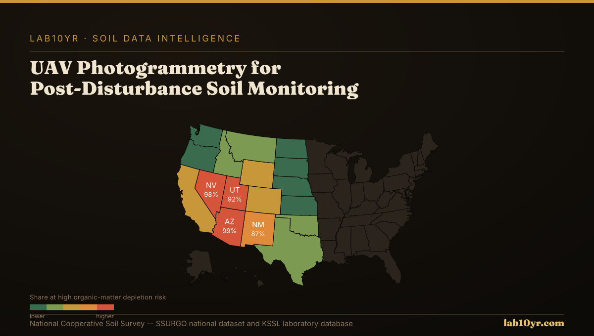
For environmental consultants, this means quantifying sediment yields for permitting compliance with unprecedented accuracy. Mine reclamation engineers can verify the success of regrading and topsoil placement, demonstrating regulatory adherence and assessing long-term stability. Wildfire recovery planners can prioritize stabilization and reseeding efforts with confidence, directing resources to specific areas experiencing the highest rates of erosion or greatest organic matter depletion. The integration of high-resolution spatial data enables targeted interventions, reducing risks and accelerating recovery.
At Lab10YR, we specialize in interpreting these complex data landscapes. We integrate the outputs from UAV photogrammetry and other remote sensing platforms with foundational SSURGO and KSSL soil properties to provide a complete picture of post-disturbance soil conditions. For example, by combining high-resolution drone DEMs with SSURGO data on initial slope, soil texture, and erodibility (Kf-factor), we can model post-disturbance water flow and predict future erosion hotspots, refining mitigation strategies. This analytical layer translates raw imagery into actionable soil intelligence, guiding critical decisions in land stewardship.
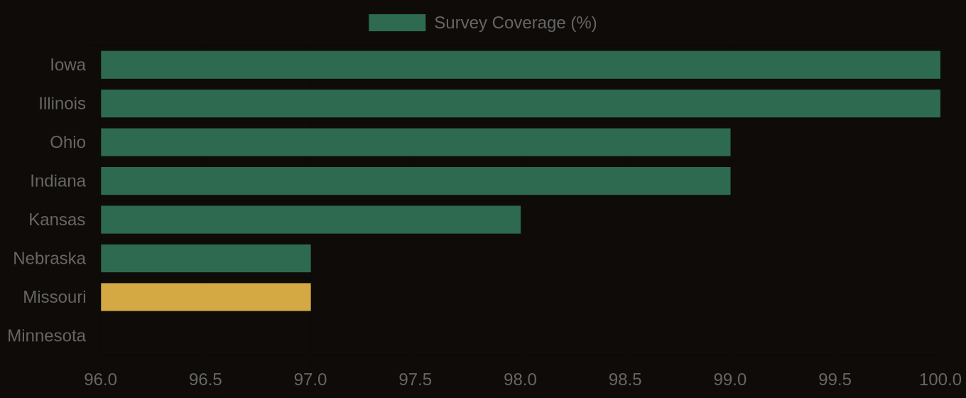
SSURGO Data Coverage — National Survey Completeness