Structure-from-Motion photogrammetry from a $1,500 drone detects sub-centimeter topographic change from one flight to the next. In mine reclamation and post-wildfire monitoring, this level of change detection replaces $50,000 ground-based survey campaigns. This unprecedented efficiency allows environmental consultants and engineers to assess erosion and deposition in near real-time, preventing catastrophic failures.
The core mechanism relies on Structure-from-Motion (SfM) algorithms. These process hundreds of overlapping images from an unmanned aerial vehicle (UAV), identifying common features and triangulating their three-dimensional positions to generate a dense point cloud. This cloud converts into a high-resolution Digital Elevation Model (DEM). Comparing DEMs from successive flights quantifies subtle shifts in surface elevation, revealing precise volumes of soil loss or accumulation. This method excels on bare or sparsely vegetated ground common after disturbances, where distinct features are identifiable. The geometric measurement complements SSURGO interpretations of inherent soil erodibility, such as the K-factor in the `chorizon` table, which quantifies a soil's susceptibility to water erosion based on texture, organic matter, and permeability.
What the Data Shows
Consider a mine reclamation project in West Virginia. Ongoing erosion of unconsolidated spoil piles releases millions in sediment into waterways, incurring severe regulatory fines and costly dredge operations. Traditional quarterly surveys often miss significant losses from rapid rainfall. Deploying UAV photogrammetry weekly allows engineers to pinpoint specific areas of accelerated erosion, enabling targeted stabilization. This prevents escalation, potentially saving hundreds of thousands in remediation and preventing environmental damage. This rapid feedback loop improves compliance and operational efficiency.
Further west, post-wildfire landscapes in the San Gabriel Mountains of California face acute risks of debris flows. After the vegetation canopy is burned, the soil surface, particularly on steep slopes with hydrophobic soil layers, becomes highly susceptible to erosion. UAV monitoring identifies nascent rills and gulleys, indicating areas where soil cohesion, informed by SSURGO properties like clay content in the `chorizon` table and rock fragments in `chfrags`, has failed. Early detection permits the rapid deployment of erosion control measures like wattles or mulching, safeguarding communities from the devastating impact of unexpected landslides.
Soil Carbon Prediction Accuracy — Spectral vs. Traditional Methods
| State / Region | R² — SOC Prediction |
|---|---|
| UAV Multispectral (5cm) | 0.87% |
| Vis-NIR-SWIR Lab Scan | 0.84% |
| Sentinel-2 Bare Soil | 0.71% |
| Landsat Composite | 0.63% |
| Field Morphology | 0.55% |
| Grid Sampling | 0.48% |
The Regional Picture
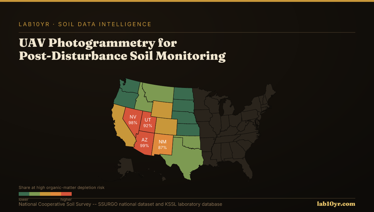
While Lab10YR does not operate drones or capture imagery, we provide the essential soil intelligence layer for interpreting UAV-derived change detection maps. We integrate client-supplied DEMs and differencing outputs with National Cooperative Soil Survey data, identifying areas where SSURGO's inherent soil properties indicate high erodibility or low water infiltration capacity, guiding rehabilitation efforts. Professionals access these foundational soil attributes through Soil Data Access queries, joining `mapunit` to `component`, then to `chorizon` and `chfrags` tables to retrieve precise soil texture, organic matter content, and K-factor values. Our analyses help connect observed surface changes to the underlying soil science, informing more resilient land management.
Timely and precise measurement of soil surface change transforms post-disturbance monitoring from a reactive cleanup effort into a proactive management strategy. By combining the geometric precision of UAV photogrammetry with the deep soil insights from SSURGO and KSSL data, land managers can make informed decisions that mitigate risk, protect assets, and accelerate ecosystem recovery. This fusion of cutting-edge sensing and foundational soil science offers a powerful framework for resilience in a changing environment.
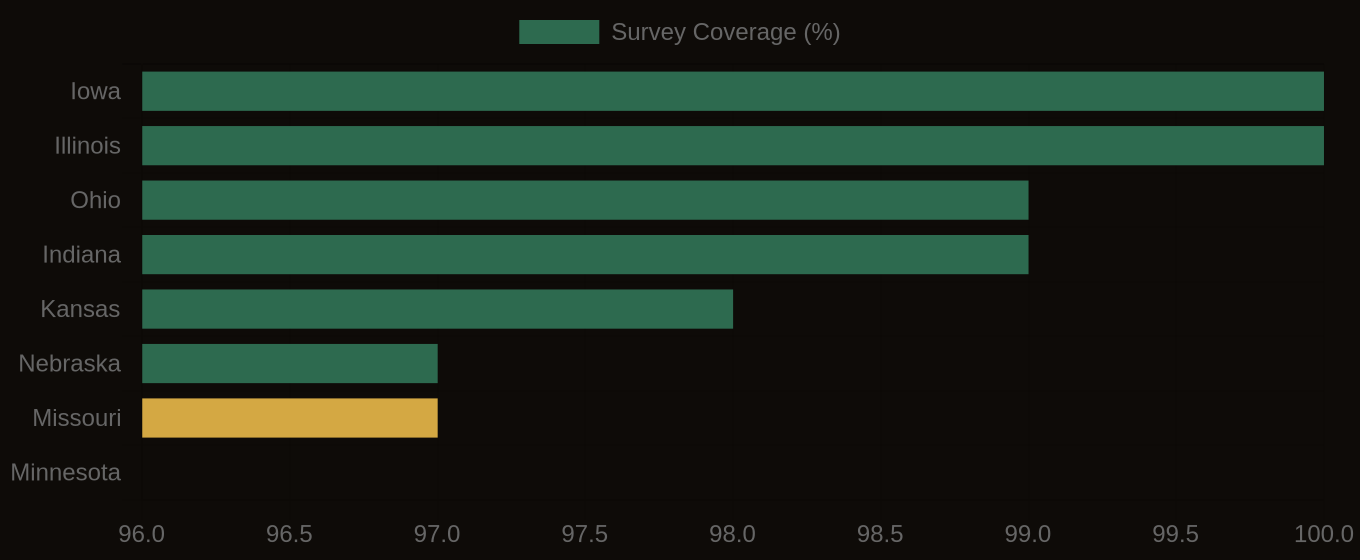
SSURGO Data Coverage — National Survey Completeness