Post-wildfire soil water repellency turns burned hillsides into concrete for up to three years. The SSURGO erosion hazard data, combined with real-time fire severity mapping, shows exactly where the runoff will go before the first storm hits, informing critical post-fire recovery efforts and risk mitigation. This immediate and severe reduction in infiltration capacity transforms landscapes, dramatically increasing the risk of catastrophic debris flows and flash floods. Soil water repellency, also known as hydrophobicity, forms when high-intensity fire heats soil organic matter to temperatures between 175 and 200 degrees Celsius. Volatilized organic compounds then move downwards into cooler soil layers or condense on the soil surface and mineral particles, forming a waxy, water-resistant coating. This coating prevents water from penetrating the soil matrix, fundamentally altering its hydrologic response. The degree of repellency is often measured by the Water Drop Penetration Time (WDPT) test, where the time it takes for a water droplet to infiltrate the soil surface indicates severity. While WDPT is a field measurement, the KSSL laboratory database contains extensive organic carbon data (accessible in the `chorizon` table via `om_r`), which is a key precursor to hydrophobic compound formation. Soils with higher pre-fire organic matter content and coarse textures, such as sandy loams, are particularly susceptible because the hydrophobic compounds can coat individual sand grains more effectively, creating a persistent barrier to water. This condition significantly exacerbates the inherent water erosion risk, which is cataloged in the `component` table of SSURGO under the `erocl` (erosion class) field, typically ranging from 'slight' to 'severe' under normal conditions. Post-fire, even soils rated 'slight' can exhibit extreme runoff.
Consider the San Gabriel Mountains in southern California, where the steep, chaparral-covered slopes of the Tujunga series (coarse-loamy, mixed, superactive, thermic Typic Xerofluvents) are naturally prone to erosion. After high-severity wildfires, these burned hillsides, now rendered hydrophobic, act as impermeable surfaces. This drastically increases their effective hydrologic group from a typical B or C to a D, meaning nearly all rainfall becomes surface runoff. This phenomenon converts heavy rainfall events into torrents, leading to devastating debris flows that can scour canyons, bury roads, and destroy homes in foothill communities. In contrast, rangelands in central Montana, characterized by the Mollisols of the Kevin series (fine-loamy, mixed, superactive, frigid Typic Haplustolls), face a different consequence. While less prone to dramatic debris flows due to gentler slopes, post-fire water repellency on these soils leads to increased sheet and rill erosion, stripping away valuable topsoil and nutrients. This reduces forage productivity for cattle and degrades water quality in adjacent streams through sediment loading, impacting fisheries and agricultural operations alike.
State by State
For engineers and watershed managers, understanding this post-fire hydrological shift is essential. A high-severity fire in the Angeles National Forest can trigger debris flows that cost millions in infrastructure damage and cleanup, as seen in the wake of the 2009 Station Fire, which led to an estimated $100 million in damages from subsequent flooding and mudslides. Without accounting for soil water repellency, hydrologic models used for culvert sizing or flood plain mapping become dangerously inaccurate, underestimating peak flows by orders of magnitude. For instance, a small watershed in the Sierra National Forest, previously modeled with a runoff coefficient of 0.3 due to its granitic soils and forest cover, can see that coefficient surge to 0.9 or higher post-fire, overwhelming existing drainage infrastructure and threatening communities downstream.
Effective post-fire recovery planning, including Burned Area Emergency Response (BAER) assessments, relies on integrating baseline soil information with real-time burn severity data. SSURGO data provides the foundational soil properties like `sandtotal_r`, `claytotal_r`, and `om_r` from the `chorizon` table (linked to `component` via `cokey` and `mapunit` via `mukey`), which indicate a soil's inherent susceptibility to water repellency and erosion. Lab10YR analyzes these attributes across 315,543 map units in the SSURGO national dataset to identify areas at highest risk pre-fire. Post-fire, these baseline soil data are combined with geospatial analysis of burn severity maps derived from satellite imagery (e.g., Landsat or Sentinel-2) to delineate areas where high heat likely induced severe water repellency. Remote sensing techniques, including multispectral drone imagery and Sentinel-1 SAR, can further refine these assessments by detecting changes in surface albedo, vegetation cover, and surface soil moisture, all of which correlate with the extent and persistence of hydrophobicity. While Lab10YR does not operate remote sensing platforms, we integrate these data streams to provide a complete interpretation of post-fire soil conditions, identifying where the underlying soil properties amplify the effects of fire and where mitigation efforts will be most effective.
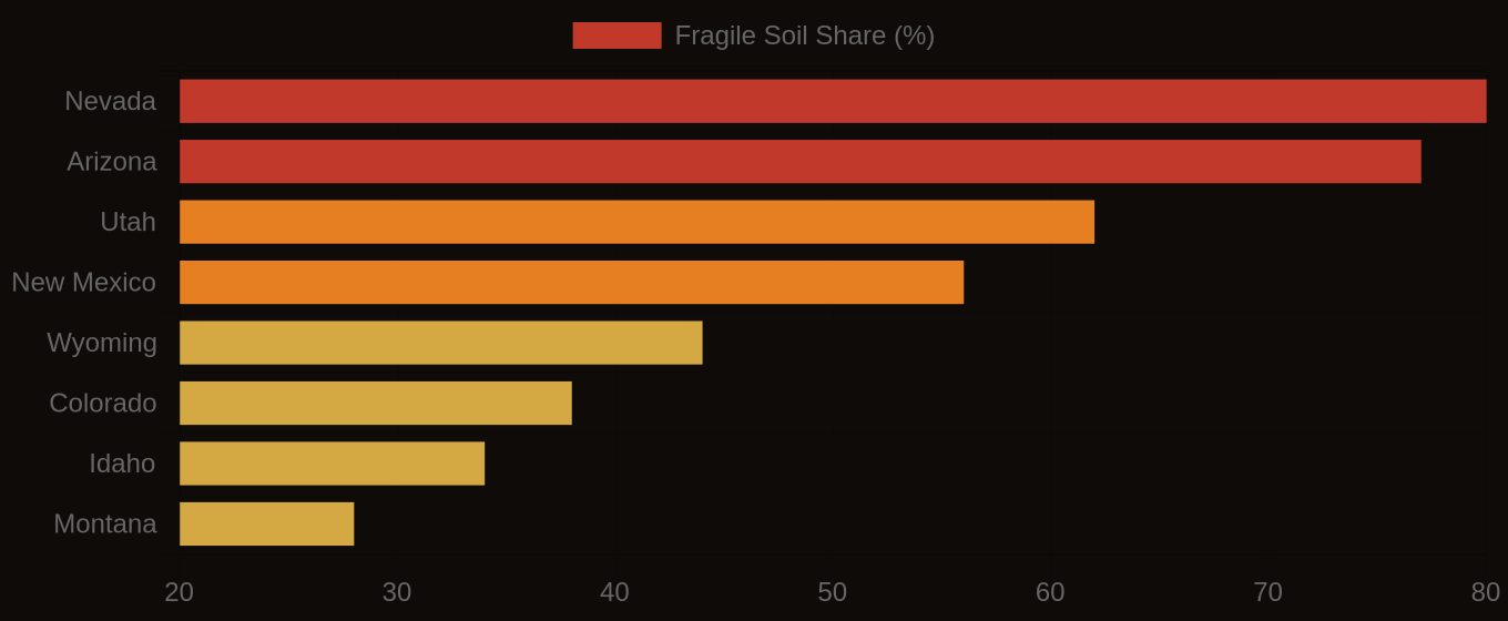
Multi-Hazard Soil Risk — Five Western States Compared
The Data Behind the Map
By using the granular detail within the National Cooperative Soil Survey's SSURGO and KSSL databases, in conjunction with geospatial burn severity data, we can move beyond generalized risk assessments. This integrated approach allows engineers, insurers, and land managers to precisely target resources for erosion control, protect critical infrastructure, and implement effective watershed restoration strategies that account for the lasting impact of wildfire on soil hydrology.
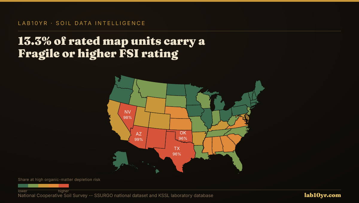
Fragile Soil Index Across America